Cherryville’s Low Walkability Score Shows Need for Infrastructure Improvements
By: Wise News Network Staff
Cherryville, NC (WNN)—Cherryville has a charming and historic downtown. However, the Environmental Protection Agency’s (EPA) National Walkability Index shows that Cherryville has a low walkability score, making it harder for people to get around on foot.

The Walkability Index rates areas on a scale from 1 to 20, divided into four categories:
- 1 – 5.75: Least Walkable
- 5.76 – 10.50: Below Average Walkable (Cherryville, NC)
- 10.51 – 15.25: Above Average Walkable
- 15.26 – 20: Most Walkable
Cherryville falls in the “Below Average Walkable” category, reflecting its car-dependent layout. Key factors influencing this rating include limited sidewalks, and wide roadways, which makes pedestrian access more challenging.

DOT Standards and Cherryville’s Gaps
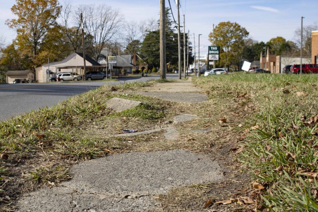
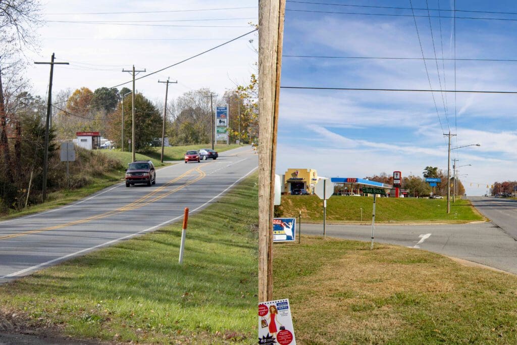
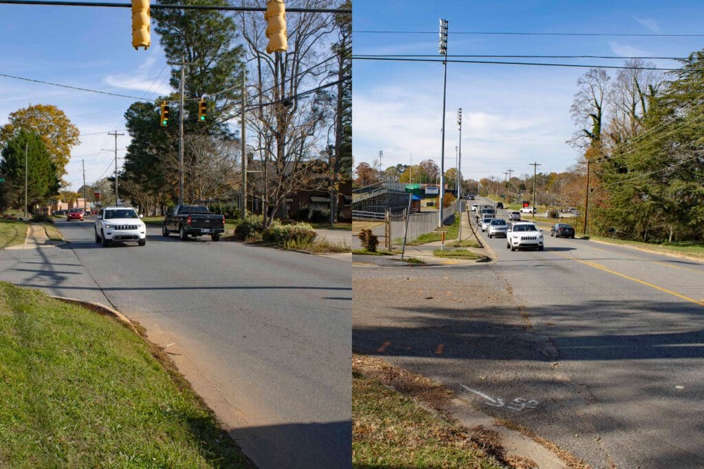
The North Carolina Department of Transportation (NCDOT) has established guidelines to enhance safety and accessibility for pedestrians in towns. NCDOT sidewalk minimum widths are 5 feet, with a 6 feet minimum requirement next to the street curb. Very few sidewalks in Cherryville meet these widths or The Americans With Disabilities Act (ADA) requirements. These guidelines include the installation of connected sidewalks, clearly marked crosswalks, and sidewalks near essential locations such as shops and schools. However, in Cherryville, many areas need to comply with these standards. Some streets have cracked sidewalks, while others lack sidewalks altogether, forcing pedestrians to walk along the edges of busy roads, which poses safety risks. On the city’s outskirts, the only supermarkets in town, Wal-Mart and Food Lion, located on Highway 150, have no sidewalks, making it difficult and unsafe for pedestrians to navigate to these areas.

The 2009 Cherryville Pedestrian Plan
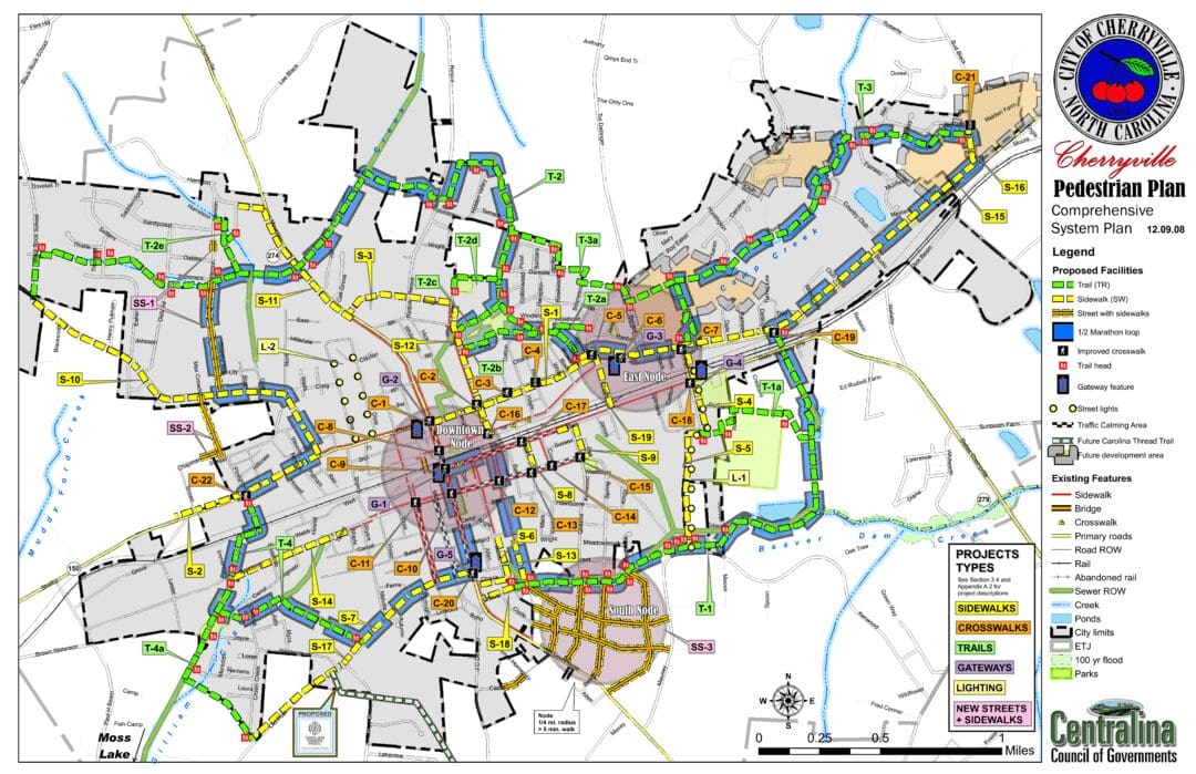
Cherryville has an extensive pedestrian plan developed in 2009 by Cherryville officials, the Centralina Council of Governments, and the NCDOT. The plan shows many new sidewalks, miles of walking trails, etc. There is mention of having a “Cherryville Turkey Trot” and more activities on the trails around Cherryville. It is also mentioned that adequate lighting is required in all areas. Cherryville currently has many dark streets and inadequate lighting throughout the city. The master plan connects the entire city, making it safe for people to walk, bike ride, or use other means. However, very little action has yet to be taken regarding the plan by city officials since 2009. To see Cherryville’s Pedestrian Plan, click here.

Cherryville’s Small Size Offers Potential for Walkability, But Infrastructure Gaps Remain
Cherryville’s small size offers a good foundation for walkability, with many areas within the town being close enough to walk to. However, the potential for a more walkable community is limited by the poor condition of existing sidewalks and the lack of sidewalks.

Learn More
For more information about Cherryville’s 2009 Pedestrian Plan, visit the link here. For the Walkability Index and Cherryville’s score, visit the EPA’s interactive map here.
@WNN
For more WNN video news stories, visit YouTube: https://www.youtube.com/@wisenewsnetwork
For more WNN articles and news stories, visit: https://wisenewsnetwork.com
Contact WNN at [email protected]
Copyright 2024 Wise News Network. All rights reserved.
